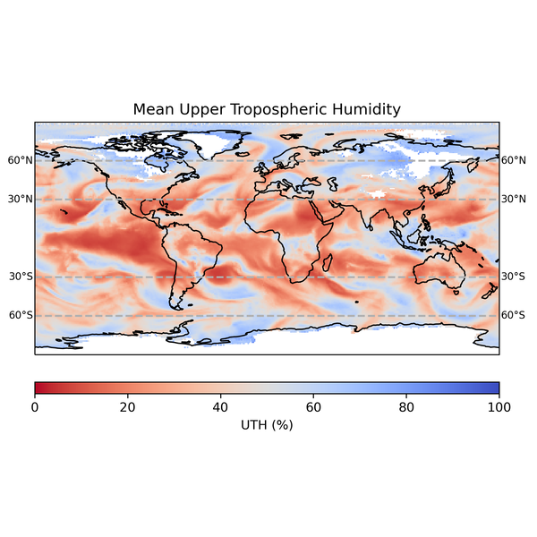
The second edition of the CM SAF Upper Tropospheric Humidity (UTH) is a satellite-based climate data record. It is a near-global 1°x1° latitude-longitude dataset that is produced with both hourly and daily time steps. The dataset is based on data from twelve passive microwave (MW) sounders operating at 183 GHz in polar orbit that are combined into a single time series covering the period 6 July 1994 to 31 December 2018. The UTH provided typically represents a broad atmospheric layer between 500 and 200 hPa. However, the exact height of this layer depends on the atmospheric conditions at the time of the observation. An optional fixed layer approximation adjustment is supplied that users can apply to provide an estimated mean relative humidity (RH) between ±60° latitude for a fixed layer between 500 and 200 hPa (mean_RH). However, users are advised to take care using this correction, especially outside of the tropics where the mean_RH is of lower quality. Users are also advised to take care using UTH observations above ±60° latitude as the retrieval is sometimes less reliable at high latitudes. Further information describing the dataset in detail can be found in the available product documentation. This is a Thematic Climate Data Record (TCDR).
Data description
Data type | Gridded |
|---|---|
Projection | Regular latitude-longitude grid |
Horizontal coverage | <TODO: Add value here.> |
Horizontal resolution | <TODO: Add value here.> |
Vertical coverage | <TODO: Add value here.> |
Vertical resolution | <TODO: Add value here.> |
Temporal coverage | <TODO: Add value here.> |
Temporal resolution | <TODO: Add value here.> |
Temporal gaps | <TODO: Add value here.> |
File format | netCDF4 |
Conventions | <TODO: Add values here.> |
Versions | <TODO: Add values here.> |
Update frequency | <TODO: Add value here.> |
Variables
Name | Units | Description |
|---|---|---|
UTH (CM-1472) | <TODO: Add value here.> | <TODO: Add value here.> |